

Panama’s third-largest island has fewer than 500 people, not a single traffic light, and a forest its own villagers saved. It’s called Cebaco, and hardly anyone has heard of it.
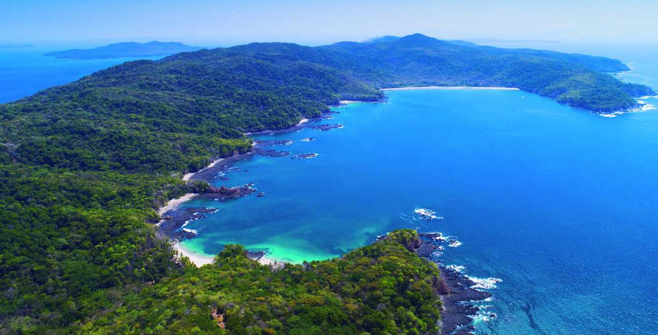
It sits at the mouth of the Gulf of Montijo, on the Veraguas coast, and from the sea it looks like a long green ridge floating off Mariato. Up close it’s something else: fishing villages, beaches you can only reach on foot, trails that run from coast to coast and, from July to October, humpback whales that come to raise their calves in its calm water.
This is our guide to Cebaco Island: where it is, what the name means, what to do, when to go and how to get there. We wrote it from El Bongo, an hour and a quarter away by boat, because it’s one of our favorite islands.
Where Is Cebaco Island?
Cebaco Island is in the Montijo district of Veraguas province, on Panama’s Pacific coast. It closes off the southern side of the Gulf of Montijo, the country’s largest RAMSAR wetland, and faces the Azuero Peninsula and the beaches of Mariato. To the west, a short crossing away, Coiba National Park begins.
- Size: about 8,000 hectares (roughly 20,000 acres). It’s long and narrow: about 25 km long and 2 to 5 km wide.
- Ranking: Panama’s third-largest island, after Coiba and Isla del Rey.
- Neighbor: Gobernadora Island, right off its west coast.
- Protection: it sits in the buffer zone of Coiba National Park, inside a special conservation zone. It isn’t a national park, so there’s no entrance fee.
On this map we marked the departure points and the places we visit on the island:
What Does Cebaco Mean? The Legend of Chief Cemaco
Nobody has it written down, but on the island everyone tells the same story: Cebaco’s first inhabitants were Indigenous, and the name comes from Cemaco, a chief from the days of the Spanish conquest. Over the centuries, “Cemaco” turned into “Cebaco.”
It’s oral tradition, and that’s how we tell it. What came after is on the record.
The Island of Mahogany
Cebaco’s elders remember a very different island. They say it was one of the richest in mahogany in all of Panama, and that the sea of Montijo was so full of fish there was plenty for everyone. There were boom years, with harvests sold on the mainland, and lean years, when the big trees were gone and land started selling to outsiders.
That’s why we love what happened in 2008. When someone tried to sell the last community forests of Chaperno (9 hectares) and Punta Campana (about 19 hectares), the people of Platanares formed a rescue committee. With the backing of the Montijo town council, both forests were protected and the community got its rights certified. A small village with no streets organized itself to look after what was theirs.
Want the story from the people who lived it? There’s a book: ¡Cébaco! La historia de Isla Cébaco, Panamá, contada por sus pobladores, by biologist Jorge Ventocilla and Cebaco farmer Agripino Rios (Editorial Futuro Forestal, 2013, in Spanish).
The Villages of Cebaco
According to the 2010 census, 474 people lived on Cebaco in 114 homes, and 41% were under 15. Almost every house is on the west coast, looking across at Gobernadora Island, and the two islands go way back. People live from small-scale fishing, farming, cattle and a little trade.
- El Jobo: the biggest village, with sidewalks, little grocery stores, a school and a community hall. Locals say its mountain water is so good it gets shipped over to Gobernadora.
- Platanares: on the north coast, facing Mariato. No streets, a school and a community hall. This is the village that saved the Chaperno and Punta Campana forests.
- Los Almacigos: a few minutes away by boat, past Los Lagartos beach. The trail across the island to Playa Grande starts here.
- El Centro and Divorcio: inland and on the east coast. Divorcio has its own wildlife reserve.
Electricity comes from solar panels, fridges run on gas, and the public phone only arrived in the 21st century. Cebaco moves at its own pace, and that’s a big part of its charm.
Cebaco Island Beaches
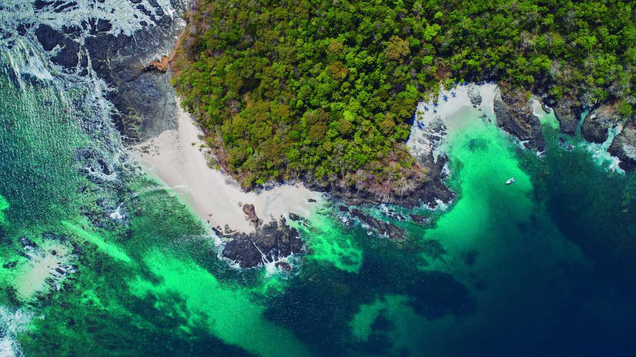
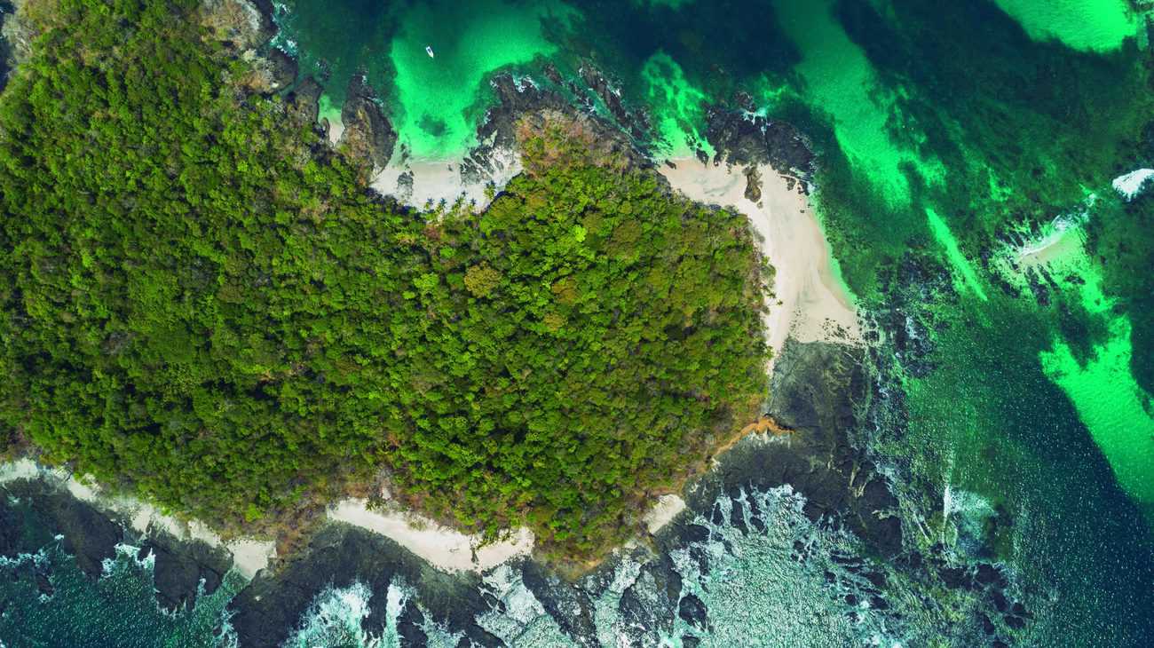
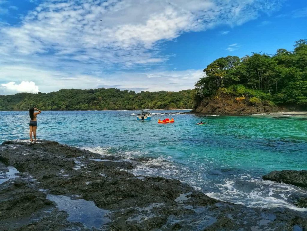
Cebaco has beaches on every side, and each coast has its own personality. The north coast, facing the Gulf of Montijo, is calm, with coarse sand, gray pebbles and shells. The south coast, open to the Pacific, has fine sand and waves.
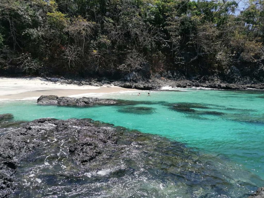
- Tintorera or Caleta Caiman: the islet at the southern tip, with small white-sand beaches, crystal-clear water and coral. Our favorite stop. Read our Tintorera guide.
- Playa Grande: on the south coast, the island’s biggest beach, with fine sand and waves up to 2 meters that get bigger in the rainy season. The Mangotal River flows out here, with fresh water even in the dry season.
- El Balso Beach: on the east side, with fresh water trickling out of the rocks.
- Chaperno Beach: right after El Balso, with fine and coarse gray sand.
- Divorcio Beach: calm water and gentle waves.
- El Jobo Beach: dark sand in front of the village, sheltered from the wind. Our plan B when the sea gets rough.
Hiking Trails on Cebaco Island
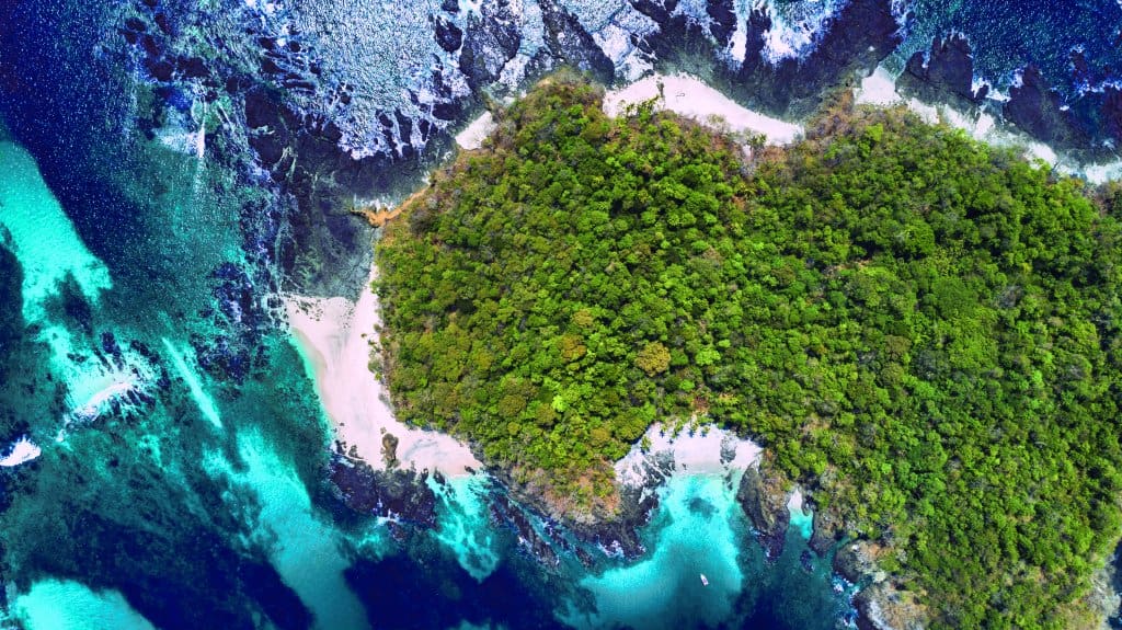
Cebaco has a forested ridge down the middle, so walking here means climbing, dropping and peeking at the sea on both sides. These are the best-known trails:
- Los Almacigos to Playa Grande: crosses the island from north to south at its narrowest point. About 3 km and 1.5 to 2 hours, with a steep climb at the start from the school. It passes El Centro and the old airstrip, which is flat.
- El Pajar Path: about 30 minutes from Platanares to the beaches of El Balso, Chaperno and Divorcio, through the Divorcio reserve.
- Naranjo Trail: about 2 hours from El Jobo to Caleta Caiman.
- East coast trail: 7.1 km out and back, 1.5 to 2 hours, easy, with empty beaches, low cliffs and almond trees (AllTrails data).
- The waterfall: a freshwater waterfall in the forest, reached by boat. And in the rainy season, when the island turns green, more waterfalls spill over the trails.
Wear shoes with good grip and bring plenty of water: with the humidity, the forest stretches are often muddy.
Wildlife and Nature on Cebaco
Cebaco isn’t a national park, but the sea around it is one of the liveliest on Panama’s Pacific coast.
- Humpback whales: from July to October, the calm water between Cebaco and Gobernadora is a refuge where mothers rest with their calves. Read more about whale watching in Panama.
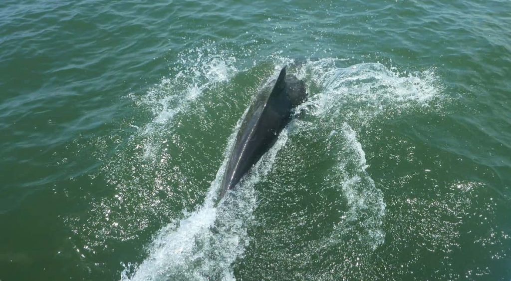
- Dolphins: the Gulf of Montijo is home to more than 80 resident bottlenose dolphins, and they often ride along with boats on the crossing.
- Sea turtles: they feed over the coral at Tintorera and nest on beaches like El Jobo and Playa Grande. If you see a nest, leave it alone and let the locals know. Learn more in our sea turtles guide.
- Birds: brown pelicans, frigatebirds, gulls and hawks along the coast, and the mangrove birds of the gulf on the way.
- In the forest: iguanas, birds and, so they say, a caiman in the Punta Guagara lagoon.
The plants tell a story too: coconut palms and almond trees on the beach, bromeliads hanging from the trunks, the barrigon tree (Pseudobombax septenatum), the gumbo-limbo (Bursera simarouba) and the maquenca palm, still used to thatch roofs on the island.
Things to Do on Cebaco Island
- Snorkeling: at Tintorera, with coral, sea turtles and colorful reef fish.
- Beach time: small white-sand beaches, usually with nobody else around.
- Hiking: coast to coast, or along the east coast.
- Surfing: at Playa Grande, especially in the rainy season.
- Fishing: good inshore fishing along the Cebaco coast all year, and Piedra del Sombrero, near Tintorera, is a great spot for tuna, snapper, wahoo and mahi-mahi.
- Whale and dolphin watching: whales from July to October, dolphins all year.
- Camping: islanders camp on the beach or in the villages; ask the community first.
Best Time to Visit Cebaco
You can go all year, but every season has its perks. Snorkeling visibility is usually best from January to April, with a shorter window in June and July. Humpback whales arrive from July to October, and dolphins are around all year. The rainy season, when the island turns its greenest, is the best time to see the waterfalls that spill over Cebaco’s trails. Those months also bring bigger waves to the south coast: great for surfing, not so much for swimming. Check our wildlife calendar, month by month.
How to Get to Cebaco Island
The only way to Cebaco is by boat. From Panama City you drive to Santiago de Veraguas and then to the coast: El Bongo and Puerto Mutis in Montijo, Santa Catalina, or Mariato, to leave from Playa Reina or Palo Seco.
- From El Bongo (Club Nautico de Veraguas): about 1 h 15 min, crossing the mangroves of the Gulf of Montijo. This is our home dock, close to Santiago, and it’s a two-for-one: you spend an hour among the mangroves of the gulf and can stop for a seafood lunch with the fisherwomen of Isla Leones on the same day. Many local anglers head out from nearby Puerto Mutis.
- From Santa Catalina: about 30 minutes, the shortest crossing.
- From Playa Reina or the Palo Seco port, in Mariato: Palo Seco is a natural harbor that doesn’t depend on the tide.
Islanders have their own names for these trips. From Mariato, the pangas leave through the mouth of the Rio Negro at the so-called “Port of the Brave,” named for how hard it is to get out in the rain with a rough sea. In the rainy season they use the calmer “Port of the Lazy.” And you have to cross at high tide.
The easiest way is a private boat, with a captain and life jackets for everyone. On our private Cebaco Island tour we leave from El Bongo, Santa Catalina or Playa Reina, up to 6 guests per boat, with snorkeling at Tintorera and lunch your way: a beach barbecue or the Adventurer’s Platter by Las Aventureras on Isla Leones.
Where to Stay on Cebaco Island
There are no big hotels on Cebaco, and that’s part of its charm. These are two places to stay on the island:
- Hostal Familiar Cebaco Island (see on Google Maps)
- BioCebaco Eco Villas (see on Google Maps)
Combining your stay with our tour? Tell us where you’re staying and we’ll plan the day with you.
Cebaco Island FAQ
Where is Cebaco Island?
In the Montijo district of Veraguas province, at the mouth of the Gulf of Montijo, on Panama’s Pacific coast, facing Mariato.
Is Cebaco Island a national park?
No. It sits in the buffer zone of Coiba National Park, inside a special conservation zone, but it isn’t managed by MiAmbiente, so there’s no entrance fee.
How long does it take to get to Cebaco?
About 30 minutes by boat from Santa Catalina, or 1 h 15 min from El Bongo, in Montijo.
Can I visit Cebaco as a day trip?
Yes. A day gives you time for the beach, snorkeling at Tintorera and lunch, and you’re back on the mainland by mid-afternoon.
Where can I stay on Cebaco Island?
There are only a few places to stay on the island, like Hostal Familiar Cebaco Island and BioCebaco Eco Villas, and camping is possible too.
Can I bring my pet to Cebaco Island?
Yes. Cebaco isn’t a protected area, so pets are allowed. We don’t really recommend it, since it’s a long day of sun and boat rides, but if you bring your dog, pack water, shade and a leash, and respect the island’s wildlife.
What should I bring to Cebaco Island?
A long-sleeve shirt for the sun, biodegradable sunscreen, water shoes, water and your original ID or passport. See our boat tour packing list.
Ready to see it for yourself? Message us on WhatsApp or book our private Cebaco Island tour.